Portfolio
Commercial property photos for a local investment group leasing properties

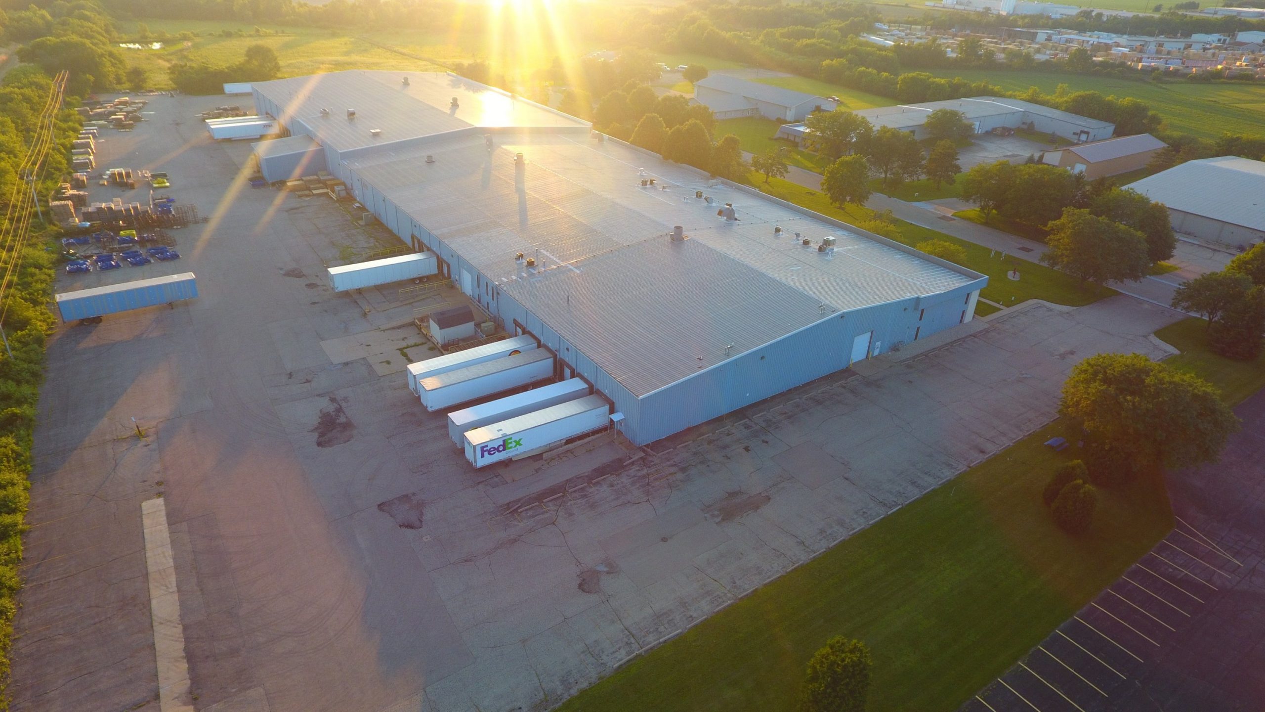
Buildings and grounds (School district)
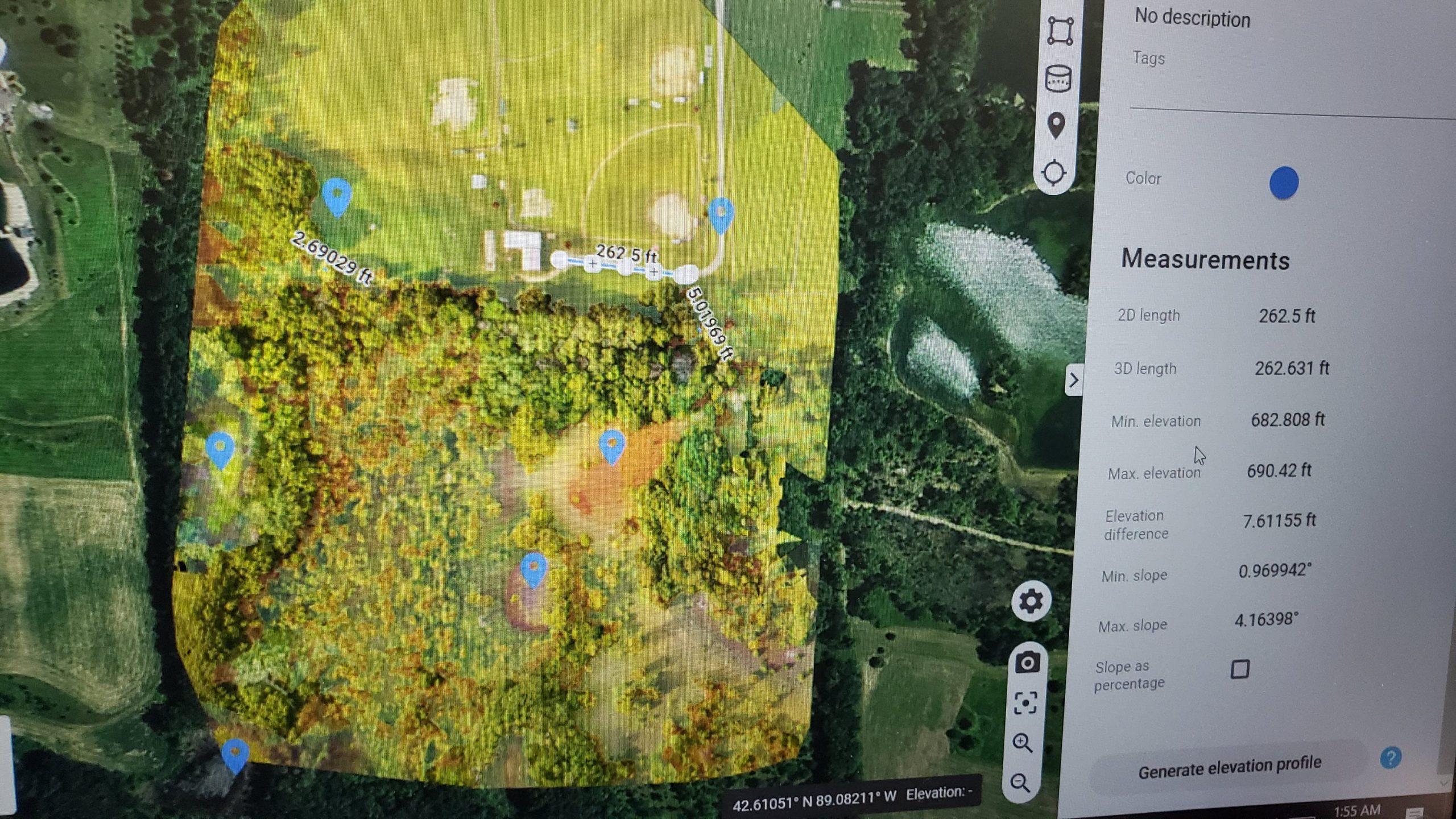
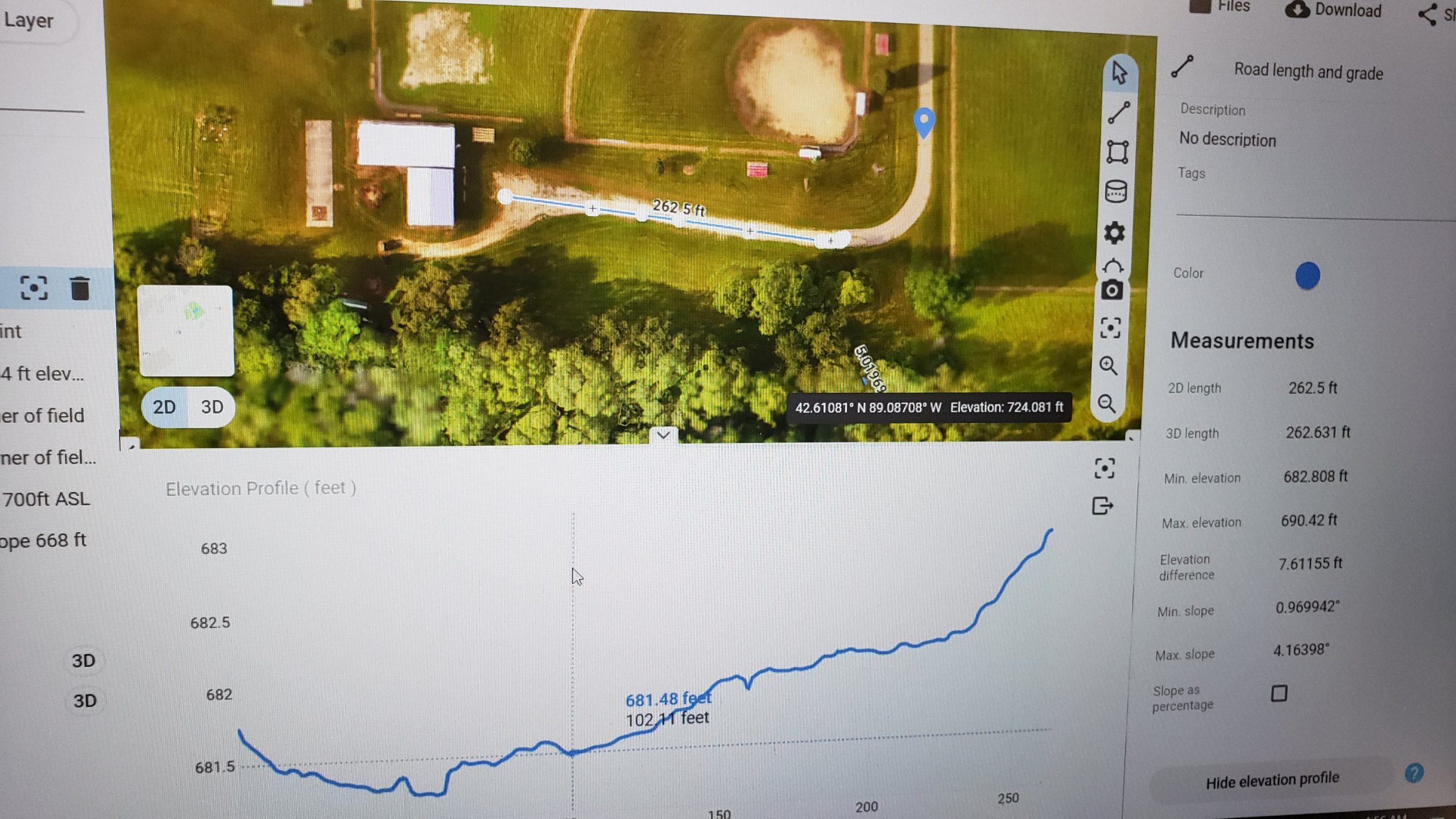
Aerial Inspection Team working hard to teach everyone about the latest advancements in safety and efficiency. On this project we mapped out elevation changes in the sports fields to help grounds crew stop water from collecting.
We also flew over 6 different school buildings to show administrators and maintenance teams any and all dmage to roofing, windows, HVAC systems and more. Using Thermal scans we can locate damage below the surface and catch it BEFORE it becomes a major issue. We were also fortunate enough to have the entire team stop out during the flights and watch on our large screens in the operations van. And at the end of it all, they recieved some amazing photos of the properties along with their reports.
By contracting with us long term they have access to photography for events and projects, surveys and mapping, inspections and more!
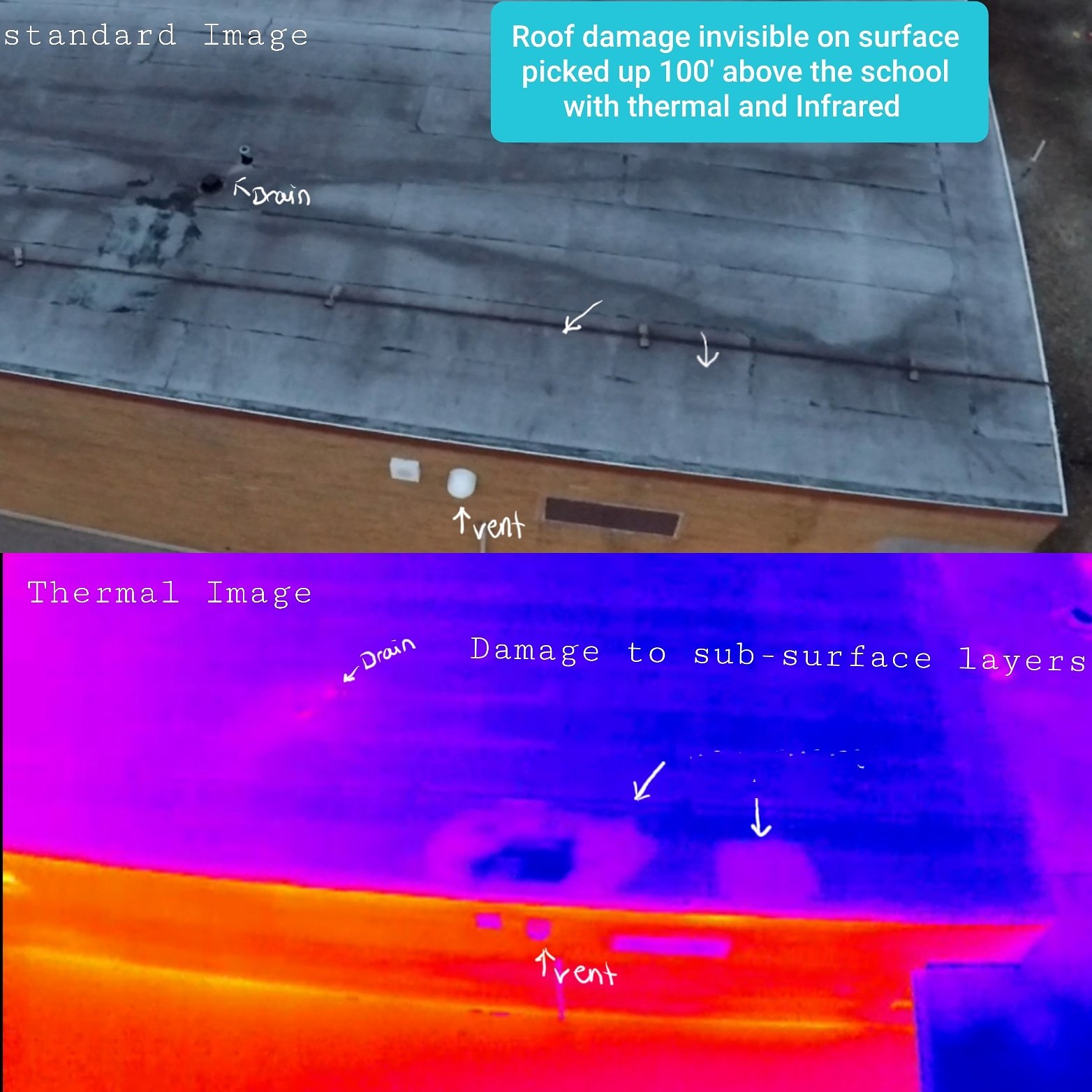
Thermal scans from recent school inspections in Janesville Wi.
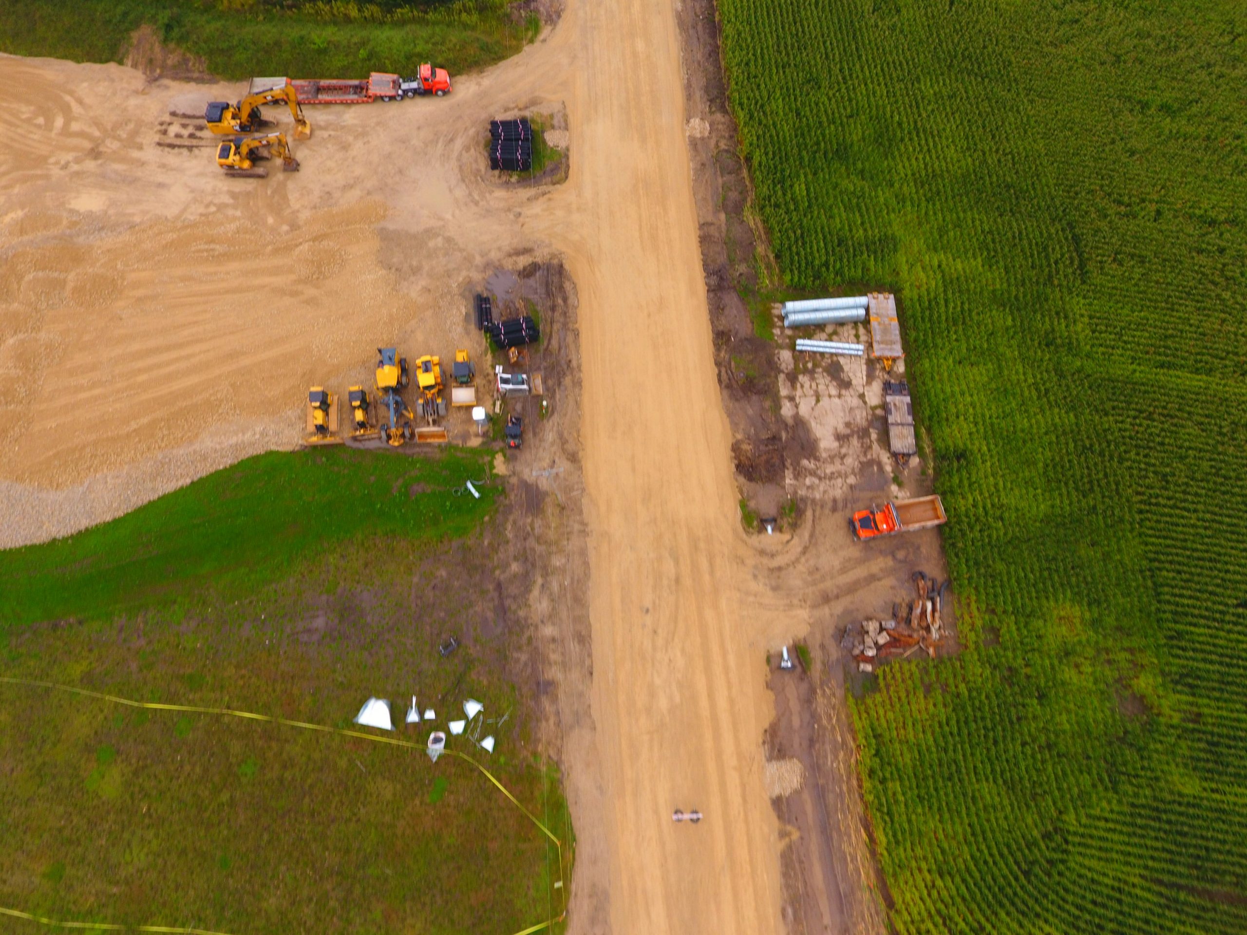
This project was for an engineering and construction company. AIT was brought in for all Aerial work allowing them to provide trusted inspections and Aerial surveys of the property with no need to have all the overhead, licensing and equipment care involved with starting a drone program. We have been told the clients also prefer damage reports from a 3rd party as it adds a layer of trust. We sign and watermark the reports and guarantee our work.

LARGE FACILITY INSPECTION
over 350,000 sq feet of roofing and structures inspected. Including standard membrane flat roof and epdm as well as all HVAC systems in 1 day of flight. Locating several areas of severe sub surface damage not visible from standard inspection. The construction consulting company was able to create 100% accurate estimates without having a single employee work in a hazardous area. The owners reduce liability and the construction team was able to offer a more accurate contract and guarantee their work.
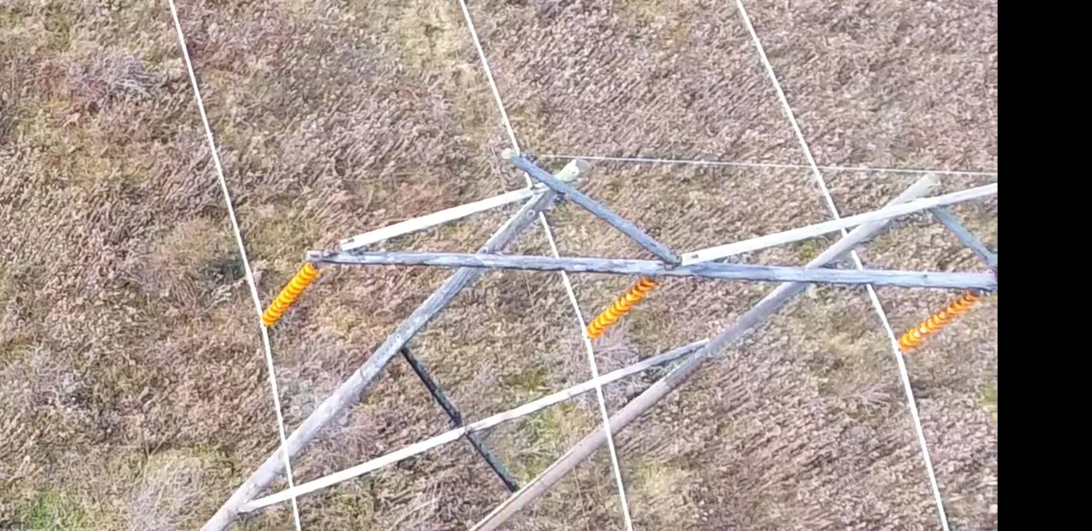
Powerline inspections
THERMAL AND HIGH DEFINITION VIDEO INSPECTIONS OF POWER LINES
3 Day inspection for energy supplier. By contracting with AIT energy suppliers are able to access remote locations covering miles of infrastructure then review all video and reports with their Team at any time. This reduces cost and safety exposure compared to manned aircraft flights and ground crews. We are able to locate any loose or damaged connections, hot spots, tree or animal damage, transformer inspections, terminals, posts etc. We also offered this company a discount for a 1 day training session for them to decide if they would like to continue contracting or hire on a full time crew and purchase equipment through our training package.
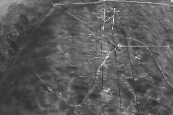
60 acres mapped and surveyed for county parks dept.
We took 2 full videos for the parks manager to share and utilize then using over 800 high definition images we were able to create a full Aerial survey using Pix-4D and global mapper software. We use several different types of software to keep up with customer needs. You can see here we were able to provide precise elevation throughout the property as well as cut and fill calculations for future construction projects. In 2 flights we were able to provide usable data on a very large site.
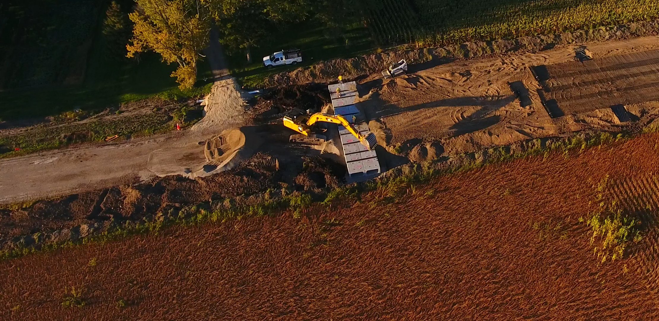
Construction Update Videos County Highway
AIT creating project update videos for county Highway dept. These videos can be used by project managers and administrators to track the progress on a job site as well as share with other departments etc. We took flights every 2 weeks for 2 months to show several sections of the 3 mile long road construction from start to finish. We also created live maps with gps location to track key points.
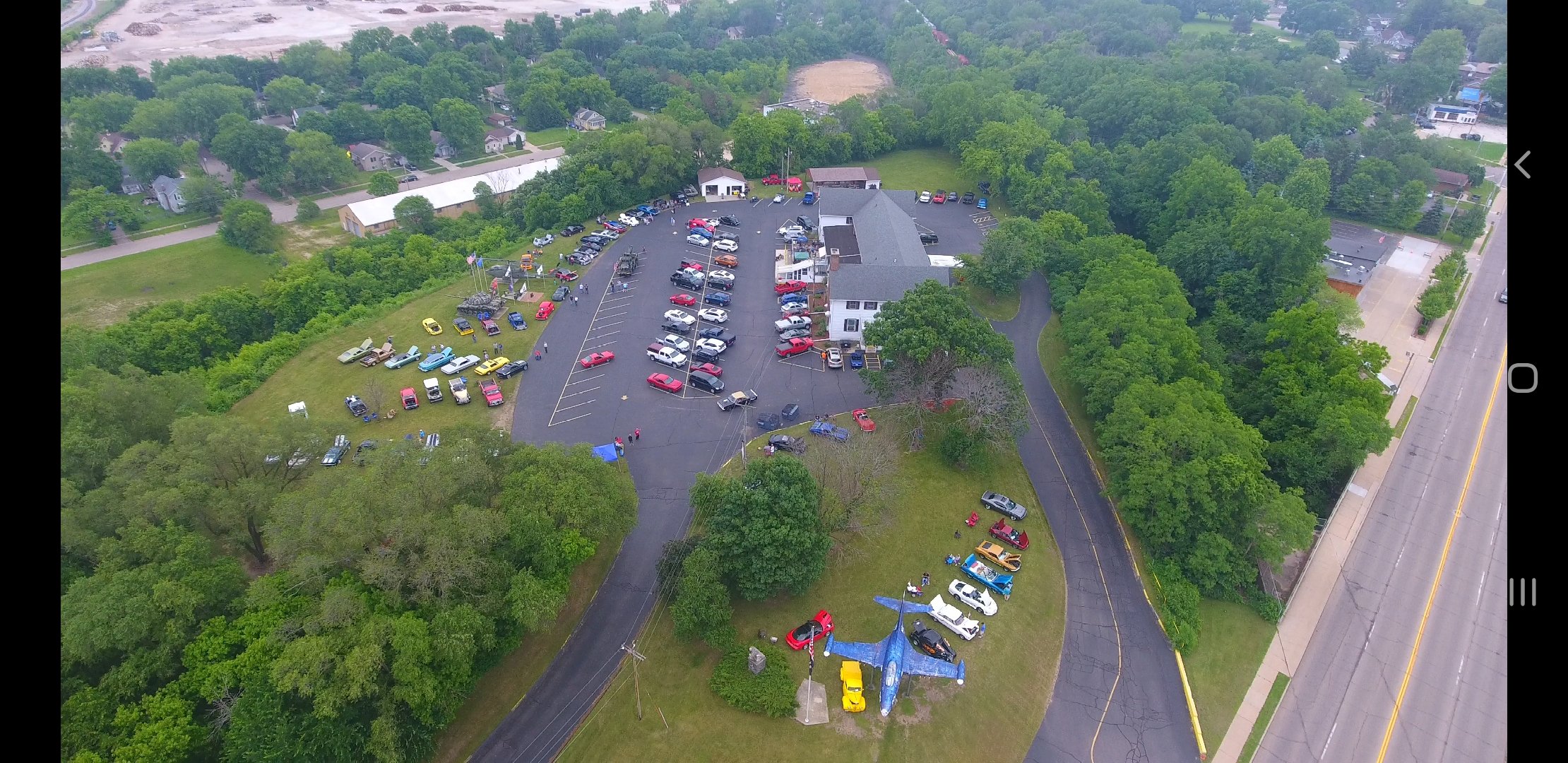
Event photography Classic Cruisers Car Club
AIT flying the car show this summer. We provide everything from single images to full videos. You can find more work by visiting our YouTube channel!